The short version
- Hurricane Polo made landfall in Baja California Sur with sustained winds of 110 mph, causing flooding and evacuations but no reported fatalities.
- Meteorologists predict the storm will weaken over land but deliver heavy rainfall to mainland Mexico and potentially cause flash floods in the U.S. Southwest.
- The active Pacific hurricane season is being driven by El Niño conditions, which are fueling warmer ocean temperatures and increased storm intensity.
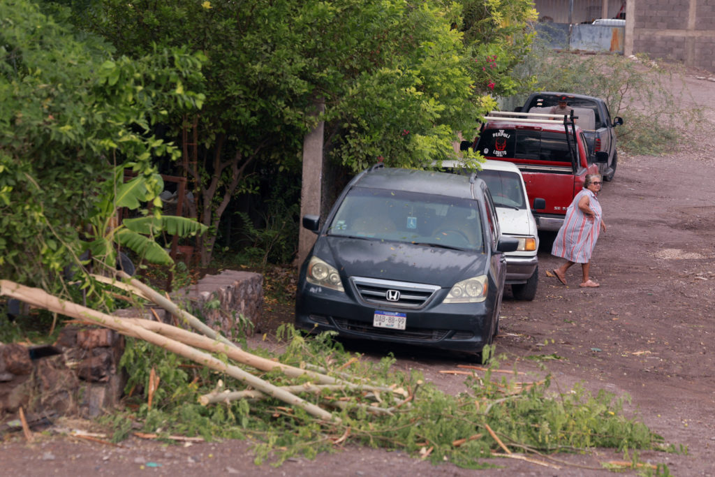
Hurricane Polo struck the Mexican state of Baja California Sur early Tuesday, bringing powerful winds and heavy rain that flooded coastal communities and downed trees. The National Hurricane Center reported the Category 2 storm made landfall just south of Las Barrancas, approximately 80 miles north of Cabo San Lazaro. At the time of impact, Polo maintained maximum sustained winds of 110 mph while moving northeast at 13 mph. Despite the intensity of the strike, Mexican authorities stated there were no serious injuries or fatalities, though about 700 people remained in shelters as of Tuesday morning.
Local officials described a scene of disruption rather than devastation. Governor Víctor Castro noted that while the hurricane brought significant rain, it did not result in loss of life. In Puerto San Carlos, waves breached sea barriers and caused flooding before the storm’s core arrived. Residents like María Palomino, a shopkeeper who sought refuge in a high school shelter, expressed relief at having evacuated. A local fishing guide described the storm as arriving with full force, prompting many to board up homes and secure property against the incoming gale.
As Polo moved inland, it began to weaken but remained a significant threat due to its moisture content. By 8 a.m. local time, the system had downgraded to a Category 1 hurricane with winds near 75 mph. The storm is currently crossing the Gulf of California and is expected to make a second landfall in the southern part of Sonora later Tuesday. Forecasters warn that Polo could dump between 6 and 12 inches of rain across parts of Baja California Sur, creating conditions ripe for life-threatening flooding and mudslides, particularly in areas with steep terrain.
The impact of this storm extends beyond Mexico’s borders. Meteorologists indicate that the remnants of Polo will push northward, sending a surge of tropical moisture into the United States. This influx is expected to affect Arizona, New Mexico, Utah, and potentially Texas later in the week. Andrew Mangham, a senior hydrologist for the National Weather Service in Albuquerque, noted that arid canyons and rocky expanses with little vegetation are highly susceptible to flash flooding when subjected to such rapid rainfall. He expressed concern that the rain is arriving too quickly, rather than gradually over the summer as would be ideal for drought-stricken regions.
Preparations have been underway in northern Mexico to mitigate potential damage. The government of Sonora announced the suspension of nonessential activities, including schools and sports, in the state capital and more than a dozen municipalities. The Mexican Navy deployed three vessels capable of delivering aid to coastal communities that might become isolated by the storm. Ports across the region were closed, and travel was suspended in affected areas. Shelters were prepared along the Baja California Peninsula to accommodate residents who chose or were required to evacuate.
The broader context of this event is an unusually active Pacific hurricane season, driven by El Niño climate conditions. Bob Oravec, a lead forecaster for the National Weather Service, stated that storm activity has been above average during the peak of the season, a pattern consistent with El Niño years when the Pacific often sees more tropical storms and hurricanes. The warm ocean waters associated with this phenomenon are fueling the intensity of systems like Polo, which has been slowly moving toward Mexico’s coastline for several days.
Other storm systems are also active in the region. Tropical Storm Rachel is moving parallel to Mexico’s coast, located southwest of Lazaro Cardenas with sustained winds of 65 mph. Meanwhile, Hurricane Nolo, a Category 3 system, has moved west past the Hawaiian islands. Nolo previously drenched communities on Hawaii’s Big Island, leading to rescues by National Guard members who saved 19 people from flooding over the weekend. The storm is now approaching the Papahanaumokuakea Marine National Monument, where it could bring dangerous conditions starting Tuesday.
Looking ahead, the focus shifts to monitoring the rainfall totals in the U.S. Southwest and ensuring that flood warnings are heeded in vulnerable areas. Some spots in the affected states could see up to 6 or 7 inches of rainfall by Thursday as Polo’s remnants merge with other weather systems. The combination of tropical moisture and existing atmospheric fronts is expected to push eastwards across the southern plains, requiring continued vigilance from emergency management agencies and residents alike.
While immediate threats in Baja California Sur are subsiding as warnings are discontinued, the long-term implications of this storm pattern remain significant. The convergence of El Niño-driven warmth and active storm tracks highlights the increasing volatility of Pacific weather systems. As Polo dissipates over land, its legacy will be measured not only in the flooding it caused but also in the heightened awareness of climate-related risks facing coastal and arid regions alike.
Sources behind this briefing
Go to the original reporting
- PBS NewsHour↗Hurricane Polo makes landfall in Baja California, toppling trees and flooding coastal communities
- BBC Science & Environment↗Hurricane Polo makes landfall on Mexico's Pacific coast