The short version
- Heat health warnings stay active across much of England through Wednesday morning as temperatures exceed 30C in southern and eastern areas.
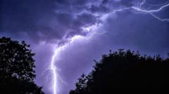
- A cold front moving southward is expected to bring scattered thunderstorms and potential hail to Northern Ireland and parts of northern England, but little rain to the drought-stricken south.
- Prolonged dry spells have led to hosepipe bans affecting over 20 million people, with forecast models suggesting limited relief for the remainder of August.
The intense heatwave gripping parts of the United Kingdom is set to continue into Tuesday, maintaining a pattern that has defined the summer season thus far. Amber and yellow heat health alerts remain in force across much of England until early Wednesday morning, signaling sustained high temperatures. Meteorological data indicates that several regions, particularly in southern and eastern England, will experience readings above 30C. Locations such as Pershore in Worcestershire and Cavendish in Suffolk have already recorded three consecutive days meeting the official heatwave threshold, a trend expected to persist for at least one more day before atmospheric conditions shift.
Despite the continued warmth, a change in weather patterns is anticipated from midweek. A cold front is projected to move southward across the Midlands and into south-east England during Tuesday. However, this meteorological shift is unlikely to provide significant relief from the arid conditions that have plagued the region. Areas including London, Essex, Kent, and Surrey are expected to see little to no rainfall. This divergence in precipitation highlights a recurring theme in recent weeks: while low-pressure systems have tracked north of the UK, delivering rain to Scotland and Northern Ireland, they have consistently failed to bring meaningful moisture to the southern half of the country.
The lack of rain has exacerbated drought conditions, making the ground increasingly susceptible to rapid runoff. Wisley in Surrey currently stands as the driest location in the UK, having gone 47 consecutive days without measurable rainfall. Many other parts of the nation have received only a fraction of their normal precipitation during June and July, contributing to what has been recorded as the driest and sunniest July in history. The scorched soil and dry grass are unable to absorb water quickly, meaning that even brief bursts of heavy rain could lead to significant pooling and flash flooding rather than replenishing water reserves.
While the south remains parched, northern regions face different weather challenges. A yellow thunderstorm warning has been issued by the Met Office for parts of Northern Ireland on Tuesday, lasting from noon until 9:00 PM. These storms may bring up to 30mm of rain within an hour or two, accompanied by strong winds and the possibility of hail. Hail formation is common in summer months when intense ground heat spawns towering cumulonimbus clouds. For residents in these areas, the sudden onset of severe weather could be a stark contrast to the predominantly hot and dry conditions experienced elsewhere.
The broader implications of this weather pattern extend beyond immediate discomfort. More than half of England has been declared in drought by the Environment Agency, leading to hosepipe bans that affect over 20 million people across England and Wales. Forecast models suggest that low rainfall and above-average temperatures will continue for much of the UK throughout August. Consequently, it is unlikely that these water restrictions will be lifted in the near future. The persistent dryness poses ongoing challenges for agriculture, water supply management, and public safety.
As the month progresses, the intensity of the heat may gradually diminish as the sun’s angle changes and daylight hours shorten. The likelihood of extreme temperatures reaching the high 30s is expected to decrease as August wears on. However, meteorologists note that spells of intense heat exceeding 30C are not uncommon even into September. This variability means that while the peak of the summer heat may be passing, the risk of sudden temperature spikes remains a factor for public health planning.
The contrast between the dry south and the storm-prone north underscores the complexity of managing climate-related risks in the UK. While some areas brace for flash flooding due to saturated or impermeable ground, others continue to grapple with severe water shortages. The situation requires careful monitoring by local authorities and emergency services, who must balance preparedness for both extreme heat and sudden severe weather events. Public advisories remain critical as residents navigate these shifting conditions.
Looking ahead, the focus remains on how long the current drought will persist and whether any significant rainfall events can break the cycle of dryness in southern England. Satellite imagery has already shown the visible impact of heatwaves and drought on the UK landscape, with brown fields and dried-up waterways becoming more common sights. Until a substantial change in atmospheric circulation occurs, the region is likely to face continued strain on its natural resources and infrastructure.
Residents are advised to stay informed about local weather warnings and adhere to any existing water conservation measures. The combination of high temperatures and low humidity increases the risk of heat-related illnesses, particularly for vulnerable populations. Meanwhile, those in northern areas should remain vigilant for sudden thunderstorms that could cause localized flooding or property damage. The coming days will be crucial in determining whether the weather pattern shifts enough to alleviate some of the pressure on water supplies.
In summary, the UK is experiencing a complex weather scenario characterized by persistent heat in the south and potential storms in the north. The ongoing drought conditions have significant social and economic implications, affecting millions of people through water restrictions and impacting agricultural output. As forecast models indicate little immediate relief, authorities and citizens alike must prepare for a continuation of these challenging conditions throughout the remainder of the summer.
Sources behind this briefing
Go to the original reporting
- BBC News↗Thunderstorms and flash flood risk on final day of UK heatwave