The short version
- The San Juan River in Pagosa Springs is projected to crest above historic levels, prompting warnings of catastrophic flooding.
- Mandatory evacuations have been issued across multiple communities in Arizona and New Mexico due to rapidly rising water levels.
- Meteorologists describe the event as an intense concentration of precipitation that typically accumulates over months occurring within a few days.
A severe weather system has triggered widespread flash flooding and mandatory evacuations across the American Southwest, affecting parts of Colorado, Arizona, New Mexico, Utah, and Nevada. The deluge began late Saturday and continued through Sunday, saturating regions that are typically arid. National Weather Service officials indicated that the storm systems originating from the Pacific could deliver up to four inches of rain in certain areas. This volume of precipitation represents a significant deviation from normal patterns for the region during this time of year.
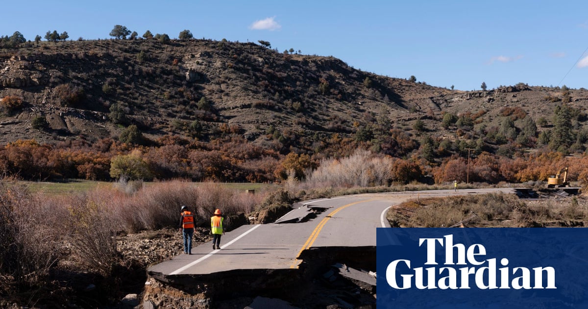
In Pagosa Springs, Colorado, authorities have issued urgent warnings regarding the San Juan River. The town, located in the Rocky Mountains near ski resorts and known for its hot springs, has a population exceeding 2,000 residents. Local officials described the potential impact as catastrophic. Forecasts suggested the river would crest at more than 20 feet late Sunday night. By sundown on Sunday, measurements indicated the water level had already reached approximately 14 feet. The Archuleta County Sheriff’s Office noted that this trajectory could exceed the levels seen during the devastating flood of 1911, which wiped out much of the town and peaked at roughly 17.8 feet.
Access to Pagosa Springs has been severely restricted. Roads leading into and out of the community were closed as water levels rose. Residents who were not subject to mandatory evacuation orders were advised to remain indoors. The situation underscores the vulnerability of mountain communities to rapid hydrological changes. The comparison to the 1911 event highlights the historical significance of the current threat, suggesting that infrastructure and preparedness measures are being tested against benchmarks established over a century ago.
Simultaneously, communities in northern New Mexico and central Arizona faced immediate dangers from rising waters. In Sedona, Arizona, officials ordered residents living near Oak Creek to evacuate immediately. Floodwaters trapped several individuals in their homes, necessitating emergency responses. Nearby Yavapai County and the community of Camp Verde issued similar evacuation directives for those residing close to swollen rivers and creeks. The geographic spread of these orders indicates a broad regional crisis rather than an isolated incident.
Further southeast, in Gila County, Arizona, authorities ordered the total evacuation of Gisela. This small community, located along Tonto Creek, has several hundred residents. The decision to evacuate entirely reflects the severity of the threat posed by the rising creek levels. More than 100 miles away in Tucson, wet conditions resulted in flash floods and river flooding. Rescue teams conducted swift boat operations to assist those affected by the sudden influx of water. The distance between these affected areas demonstrates the extensive reach of the storm system across the state.
Meteorologists have characterized the intensity of the rainfall as unprecedented in its concentration. Aaron Hardin, a meteorologist with the National Weather Service in Tucson, stated that the region was receiving two or three months worth of rain within a span of just a couple of days. This rapid accumulation overwhelmed local drainage systems and natural waterways. In Flagstaff, Arizona, rain fell nearly continuously on Sunday, flooding local roads and overwhelming storm drains. The sheer volume of water moving through the landscape has created hazardous conditions for both residents and emergency responders.
The human cost of the flooding is already evident. In Flagstaff, authorities were searching for a man who slipped and fell into fast-moving floodwaters. Police statements indicated that he was not seen resurfacing after entering the current. This incident highlights the immediate dangers posed by swift water conditions during such events. The combination of heavy rainfall, saturated ground, and rising river levels has created a volatile environment where safety risks escalate quickly.
Flood warnings and watches were issued for nearly all of Arizona, parts of southern Utah, southwestern Colorado, western New Mexico, and portions of southern Nevada. These alerts covered the sparsely populated Four Corners region where the four states meet. The weather service expects the saturation to continue through Monday. As the storm systems persist, the risk of further flooding remains high. Residents in affected areas are urged to heed evacuation orders and avoid travel on closed roads. The coming days will determine the full extent of the damage and the long-term impact on these communities.
The event serves as a stark reminder of the increasing volatility of weather patterns in the Southwest. While the region is accustomed to dry conditions, the intensity of this rainfall challenges existing infrastructure and emergency response capabilities. Officials are working to manage evacuations and provide assistance to those displaced or trapped by rising waters. The situation remains fluid, with water levels expected to continue rising in some areas before receding. Monitoring of river crests and weather developments will be critical in the immediate future.
As the storm system moves through the region, the focus shifts from prevention to response and recovery. The potential for landslides and further infrastructure damage remains a concern, particularly in mountainous terrain. Communities that have faced similar events in the past are drawing on historical data to guide current actions. The comparison to the 1911 flood in Pagosa Springs provides a benchmark for understanding the scale of the threat. Whether this event will be remembered as a historic outlier or part of a broader trend remains to be seen, but its immediate impact is profound and widespread.
Sources behind this briefing
Go to the original reporting
- The Guardian World↗Colorado town braces for historic flood as heavy rains batter south-west