The short version
- Two fatalities occurred due to falling trees in Florida and Alabama after Isaias struck the panhandle as a Category 2 hurricane.
- Over 868,000 customers across three states remain without electricity while officials warn of continued flash flooding and tornado threats.
- The storm marks an unusually late start for the Atlantic hurricane season, defying earlier predictions of a quiet year driven by El Niño conditions.
Hurricane Isaias has weakened to a post-tropical cyclone after making landfall on Florida’s panhandle late Friday, but significant dangers remain as the system moves inland. Authorities confirmed two deaths associated with the storm, both resulting from trees collapsing onto homes. One incident occurred in Escambia County, Florida, while the other took place in Birmingham, Alabama, as the weather system pushed further into the interior.
Despite the reduction in wind intensity, forecasters emphasize that the threat has not passed. The National Hurricane Center warned of considerable impacts across southern Alabama, southwestern Georgia, and the Florida panhandle. Risks include flash flooding, urban inundation, and river rises, with a particular concern for landslides in the southern Appalachian region. Tornado warnings are expected to persist through Saturday afternoon across parts of Georgia, the Carolinas, and eastern Florida.
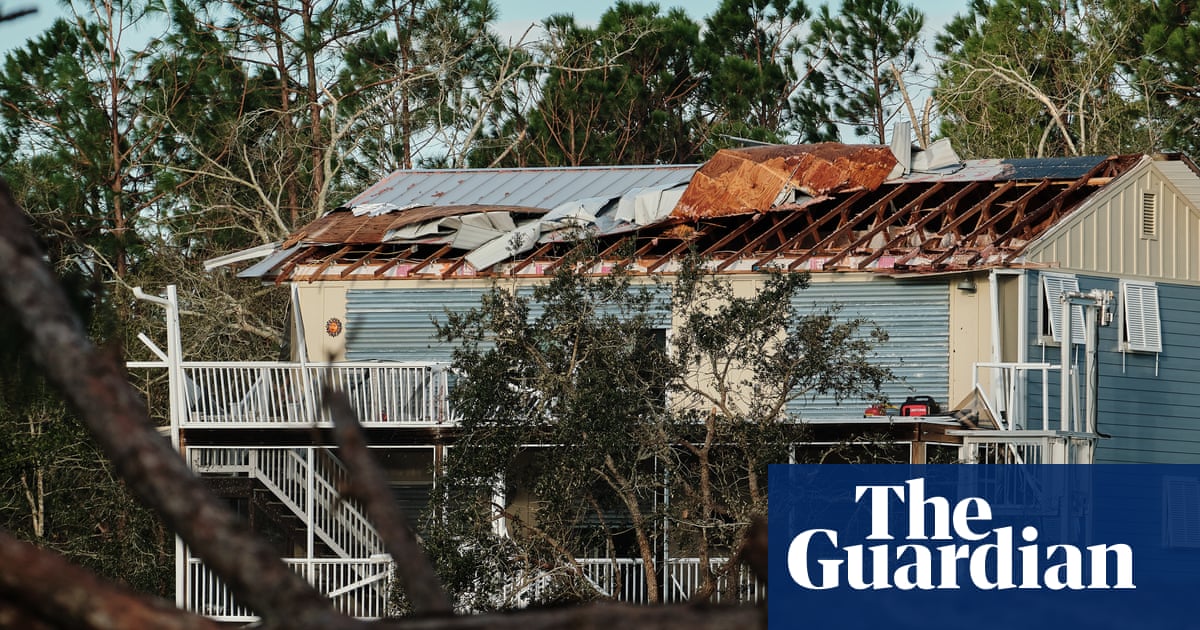
Infrastructure damage is widespread, with more than 868,000 customers losing power across Florida, Alabama, and Georgia as of early Saturday. Cleanup efforts have begun in some areas, but residents face hazardous conditions including downed trees and severed power lines. In Pensacola, Florida, resident Tim Mowry described the wind noise as resembling a train whistle. He reported that his son attempted to drive between two properties about fifteen minutes apart but was forced to turn back due to blocked roads.
Personal accounts highlight the sudden violence of the storm’s impact on residential structures. Ashley Weeks, a resident of Crestview, Florida, stated that a tree from her backyard crashed through the roof near her daughter’s bedroom. She described the sound as similar to an explosion and noted the debris scattered across the ceiling, expressing fear for her family’s safety and belongings during the event.
Rainfall projections indicate heavy precipitation will continue through Sunday. Southern Alabama, the Florida panhandle, Big Bend regions, and southwestern Georgia are expected to see between four and eight inches of rain. Localized totals could reach up to fifteen inches within specific rain bands. Broader areas across the Southeast may receive two to five inches, with isolated spots in the southern Appalachians and coastal Carolinas potentially seeing up to ten inches.
State officials have issued urgent warnings regarding ongoing hazards. Alabama Governor Kay Ivey cautioned residents about potential spinoff tornadoes and strong winds, advising them to prepare for the worst-case scenarios despite any hope for better conditions. She emphasized the need for reliable information as weather patterns evolve over the weekend, particularly for those considering travel.
Florida Governor Ron DeSantis stated that his administration had not received reports of fatalities within the state at the time of his Saturday morning comments. He attributed this outcome to heightened preparation levels and the state’s prior experience managing tropical systems. DeSantis noted that Florida’s geographic location necessitates regular engagement with such weather events.
The emergence of Isaias in October represents a statistical anomaly for the Atlantic hurricane season. It ties the record for the latest-forming first Atlantic hurricane, matching a date set in 1905. This development contrasts sharply with earlier forecasts from the National Oceanic and Atmospheric Administration, which predicted a quiet season with only two to six hurricanes due to strong El Niño conditions.
Historical data shows that the second-latest date for the first Atlantic hurricane was September 11, 2002. Isaias’s formation in October, with maximum sustained winds reaching 105 mph, underscores the unpredictability of seasonal trends. The storm is expected to dissipate by Sunday, but the aftermath will require extensive recovery efforts across multiple states.
As the system weakens, attention shifts to long-term restoration and safety assessments. Residents are advised to remain vigilant against secondary hazards such as unstable structures and contaminated floodwaters. Emergency management agencies continue to monitor conditions closely, ensuring that resources are allocated effectively to support affected communities in the coming days.
Sources behind this briefing
Go to the original reporting
- The Guardian World↗Two dead as Isaias weakens to post-tropical cyclone after striking Florida panhandle