The short version
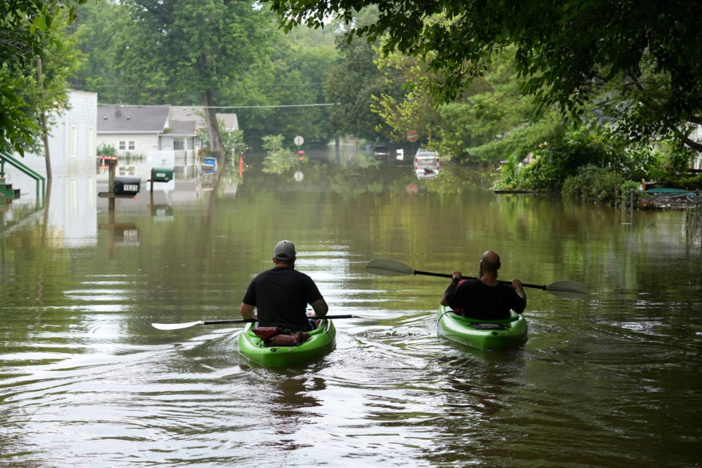
- At least seven fatalities have been confirmed in Indiana following days of record-breaking rainfall and flooding.
- Flood watches remain active for parts of West Virginia, Ohio, and Kentucky as a cold front approaches the East Coast.
- Utility crews continue to restore power to over 100,000 customers in Indiana, though numbers have decreased from recent peaks.
A persistent band of severe weather is moving eastward across the United States, carrying significant flood risks from the Midwest into the mid-Atlantic region. The National Weather Service indicates that repeated cycles of heavy rain and thunderstorms will persist for another day before a cold front clears the pattern off the East Coast on Tuesday. This extended period of unsettled conditions has already resulted in deadly consequences, particularly in Indiana, where authorities are managing the aftermath of record-setting flooding.
In Indiana, the human toll of the storms that began on August 11 is now confirmed at seven deaths. State officials identified the victims as a four-year-old boy, three men, and three women. Among those who perished was James Briar, a 31-year-old cyclist found early Sunday in Henry County, east of Indianapolis. Local coroner Brian Clark stated that Briar appears to have bypassed a barricade on a washed-out road and fallen into a collapsed section created by the rushing waters.
While floodwaters in Indianapolis’ White River began to recede and rainfall intensity eased in other parts of the state by Sunday, the danger has not fully passed. A flood warning remained in effect Monday morning for portions of Randolph County in east-central Indiana. Thunderstorms had already deposited between one and two inches of rain in that area by 8 a.m., complicating recovery efforts and maintaining the threat of further flash flooding.
Jacob Spence, director of the Metropolitan Emergency Services Agency in Indianapolis, emphasized that despite some positive trends, the response effort is far from complete. City officials launched a dedicated website on Sunday to assist residents affected by the disaster. The infrastructure damage has been extensive, with rivers cresting and setting records while roads and bridges suffered serious harm or were washed out entirely by the volume of water.
Beyond Indiana, the storm system continues to pose immediate threats to neighboring regions. Much of West Virginia, southeast Ohio, and northeast Kentucky are under flood watches through Monday evening. The primary concern in these areas is that high water levels from previous storms have left the ground saturated, significantly increasing the likelihood of flash flooding even with moderate new rainfall.
The broader impact of this weather system extends across the Midwest and into western Pennsylvania. Communities from Illinois to the mid-Atlantic have experienced serious damage from a combination of tornadoes, heavy rains, and flash flooding. The National Weather Service forecasts that heavy rain and thunderstorms will continue to affect the upper Ohio Valley and central Appalachians, with the possibility of severe storms emerging late Monday in eastern Tennessee and western North Carolina.
Infrastructure recovery remains a major challenge in Indiana, where more than 106,000 utility customers were without power as of Monday morning. This figure represents a significant decrease from the peak of approximately 300,000 outages reported earlier in the week, according to data from PowerOutage.us. The gradual restoration of electricity underscores the scale of the damage inflicted by the drenching rains and destructive flooding.
As the weather pattern shifts, attention is turning toward the mid-Atlantic states where the next phase of the storm system is expected to arrive. Meteorologists warn that the combination of lingering moisture and new precipitation could lead to dangerous conditions in areas already stressed by recent weather events. Residents in flood watch zones are advised to remain vigilant as the cold front approaches, which may bring a change in conditions but also potential for final bursts of severe weather.
The ongoing situation highlights the vulnerability of infrastructure and communities to extreme weather events that span multiple days and regions. While some areas begin the long process of cleanup and repair, others are bracing for the arrival of the storm system. The transition from active flooding to recovery mode is uneven, with some locations still facing immediate threats while others deal with the aftermath of record-breaking water levels.
Officials continue to monitor the situation closely, providing updates as conditions evolve. The focus remains on public safety, ensuring that residents in affected areas have access to necessary resources and information. As the cold front moves through, it is expected to clear the immediate threat of heavy rain, but the long-term impacts of this weather event will likely be felt for weeks to come.
Sources behind this briefing
Go to the original reporting
- PBS NewsHour↗Flooding risk remains as deadly storms move from the Midwest to the mid-Atlantic